Apple today announced the release of a new mobility data trends tool using information collected from from Apple Maps, which is designed to help mitigate the spread of COVID-19 by providing helpful insights to local governments and health authorities.
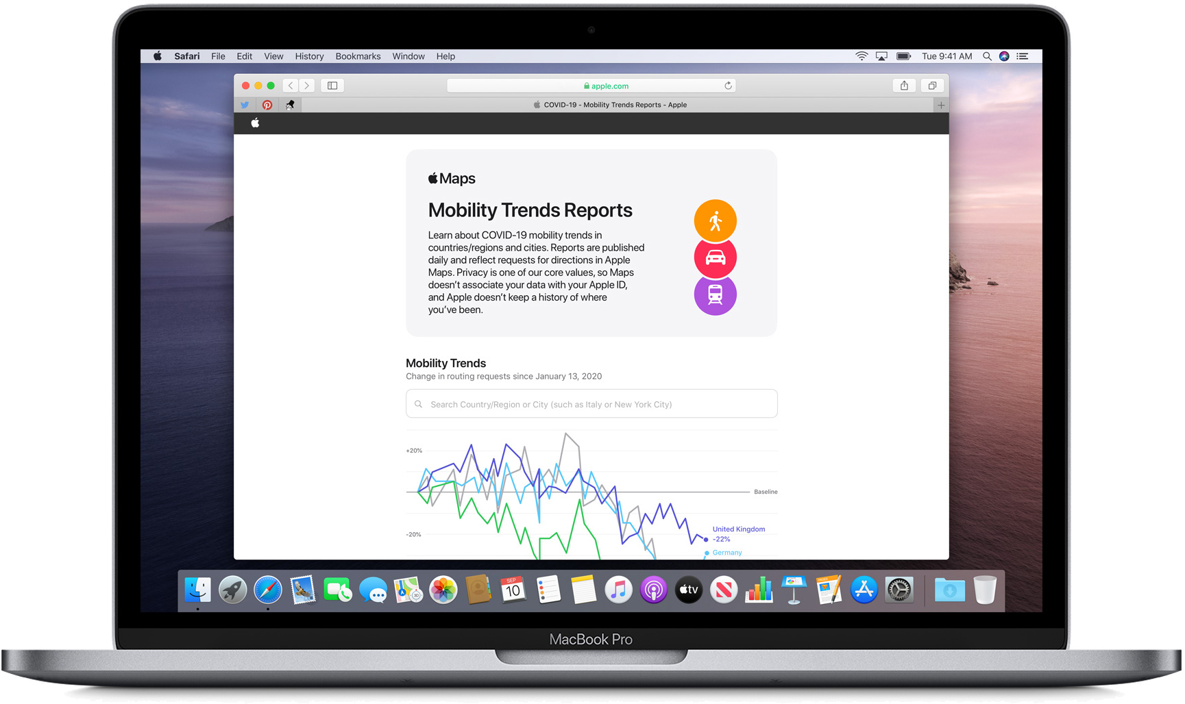
Apple believes that the data could be used as a foundation for new public policies by showing changes in the volume of people driving, walking, or taking public transit.
The mobility data site uses aggregated data collected from Apple Maps to show mobility trends for major cities and 63 countries or regions. Apple generates the data by counting the number of requests made to Apple Maps for directions.
The data sets are compared to reflect a change in the number of people who are driving, walking, or taking public transit, and Apple says that data availability in a particular place is subject to factors like minimum thresholds for direction requests made per day.
Mobility data sourced from Apple Maps is not associated with a user's Apple ID and Apple does not keep a history of where a user has been. Data collected by Maps, such as search terms, navigation routing, and traffic information is associated with random, rotating identifiers that continually reset, which prevents a profile of movements and searches from being built.
Tag: COVID-19 Coronavirus
This article, "Apple Releases Apple Maps Mobility Data Trends Tool to Help Mitigate COVID-19 Spread" first appeared on MacRumors.com
Discuss this article in our forums


from MacRumors: Mac News and Rumors - All Stories https://ift.tt/2RF7dHz
No comments:
Post a Comment
Leave your thoughts....